IoT Monitoring Geospatial Analysis AI Prediction Biodiversity Map

Where DATA meets the deep sea, and AI meets the heart of the fisherfolk.

BUGSAi is an innovative marine monitoring and decision-support system that combines IoT devices, geospatial analytics, and AI models to promote sustainable fishing and biodiversity conservation.
“Real-time insights for ecosystem management, risk reduction, and policy support.”
Governance-ready Weather-aware Analytics-first
BUGSAi Hero

About BUGSAi

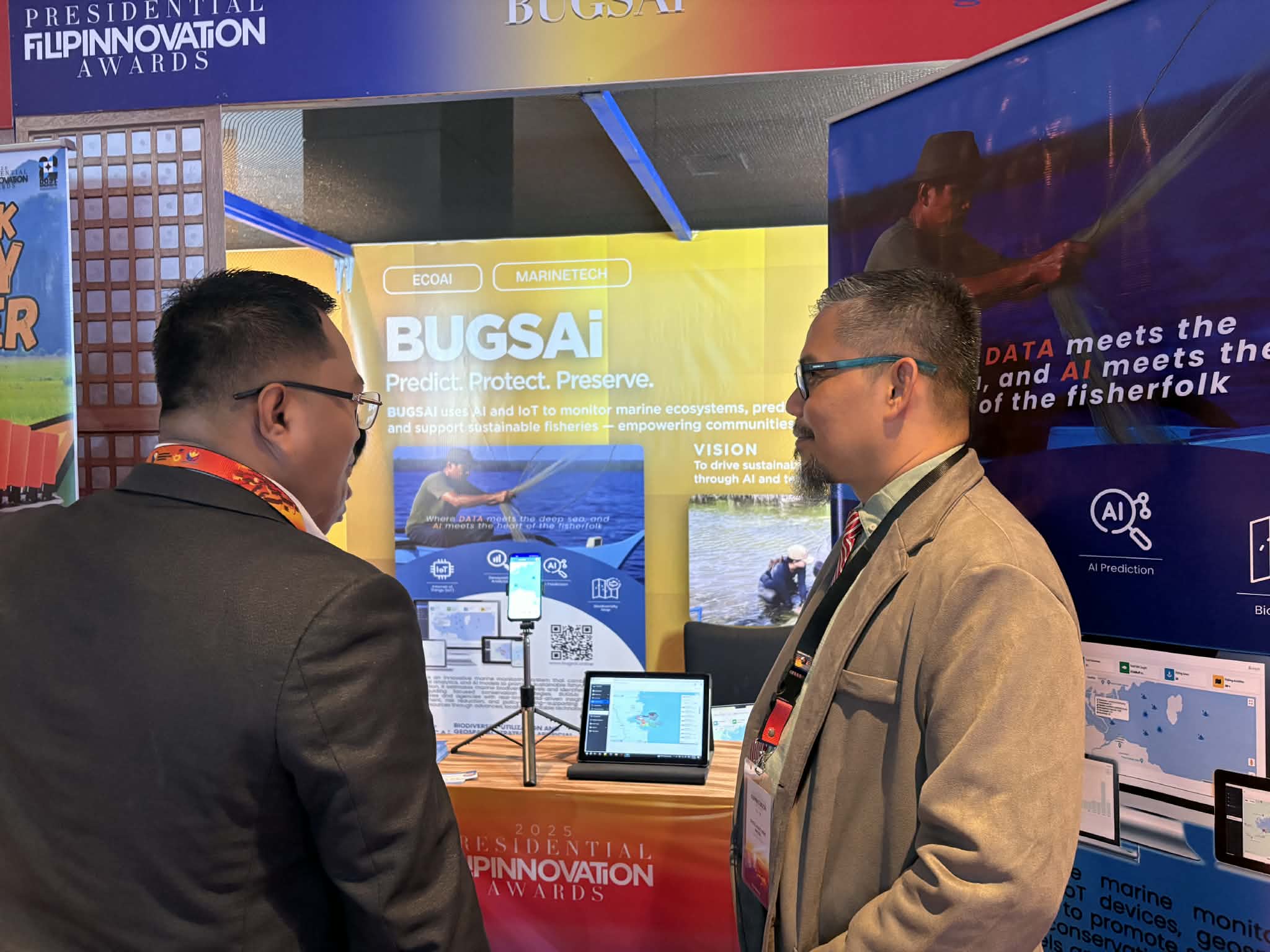
BUGSAi equips coastal communities and agencies with real-time, data-driven insights for ecosystem management, risk reduction, and evidence-based decision-making. It can estimate biodiversity levels, identify high-risk fishing zones, and provide actionable analytics for fisheries planning and conservation strategies—built to be locally adaptable and scalable.

IoT
Boat monitoring & sessions
GIS
Geospatial mapping & zones
AI
Prediction & biodiversity insights
BUGSAi App Logo
BUGSAi Platform

Key Features

Core modules that power BUGSAi’s marine intelligence.
Modular & scalable
IoT Boat Monitoring

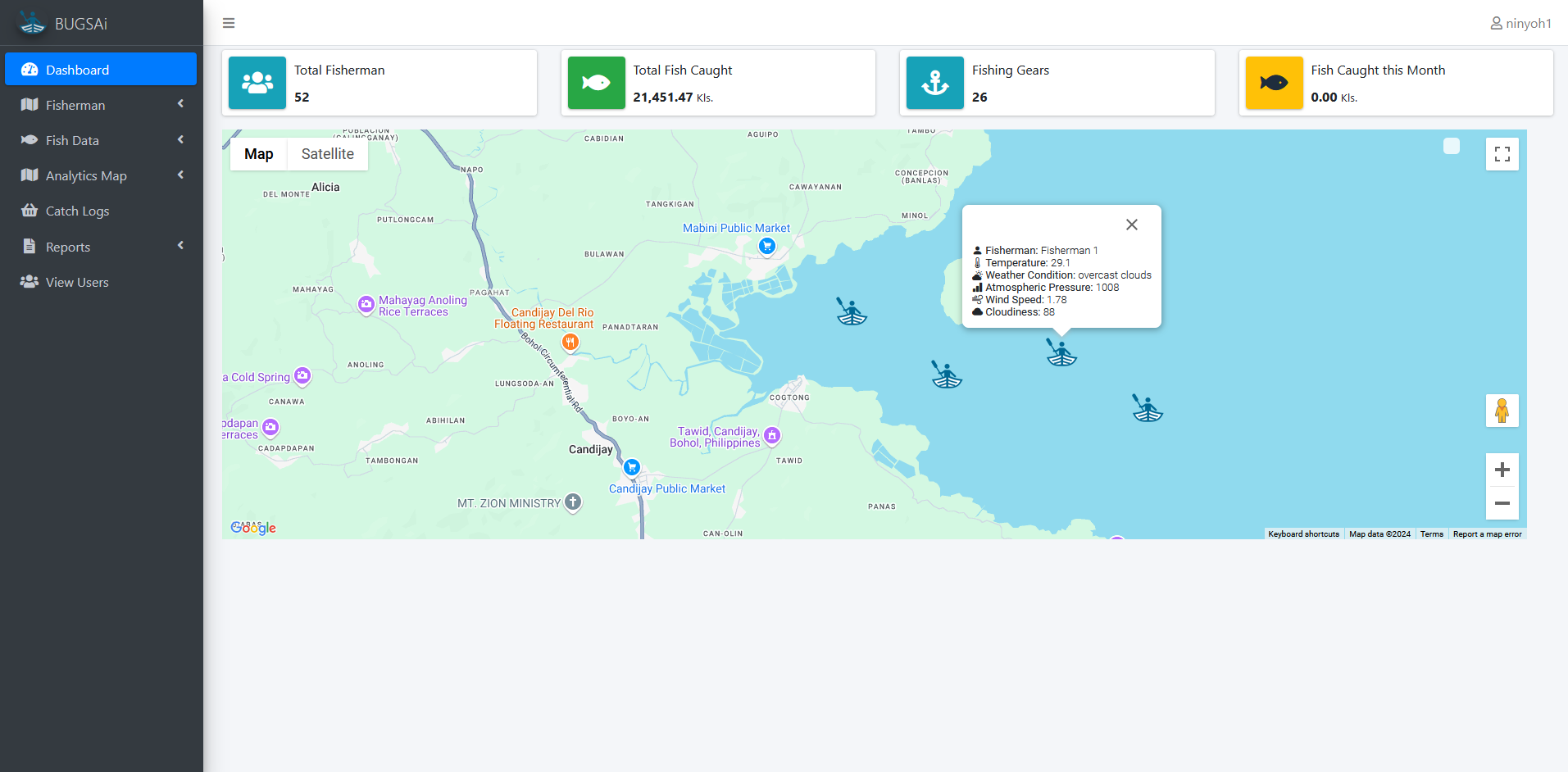
Track devices, boats, and activity sessions to build reliable operational datasets.

Geospatial Analysis

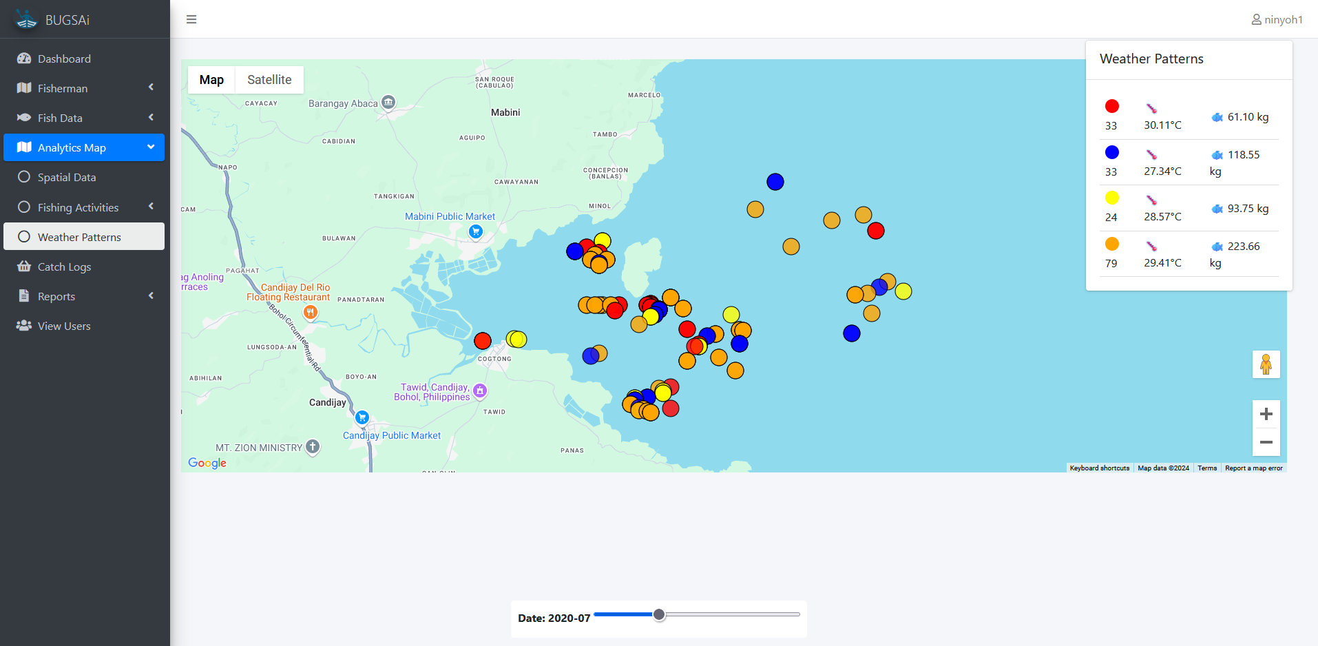
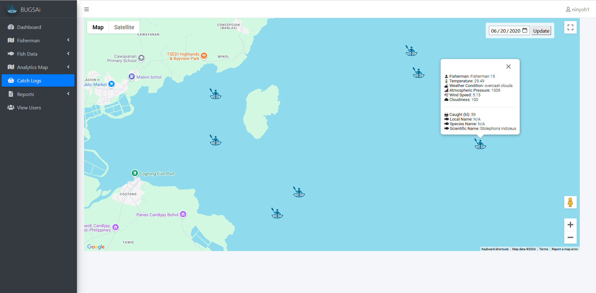
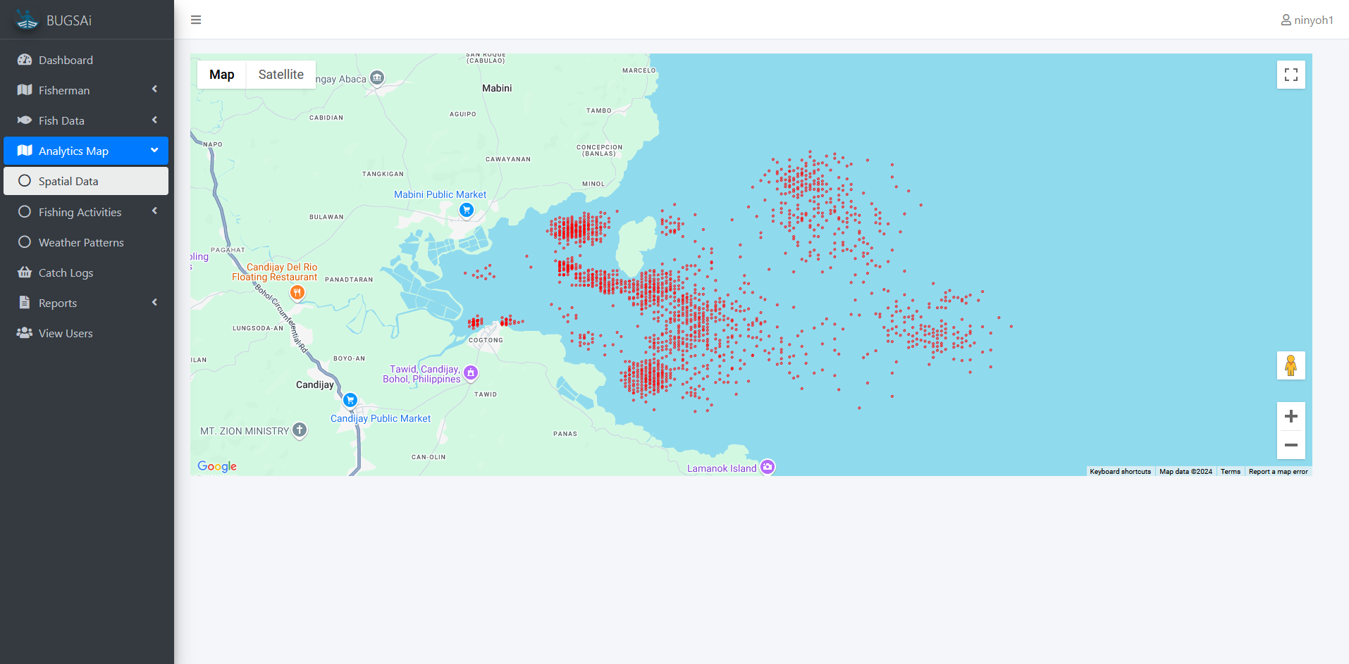
Visualize routes and zones; support mapping-driven insights for governance and planning.

AI Prediction

Use AI models to estimate risk levels, trends, and biodiversity-related indicators.

Catch Intelligence

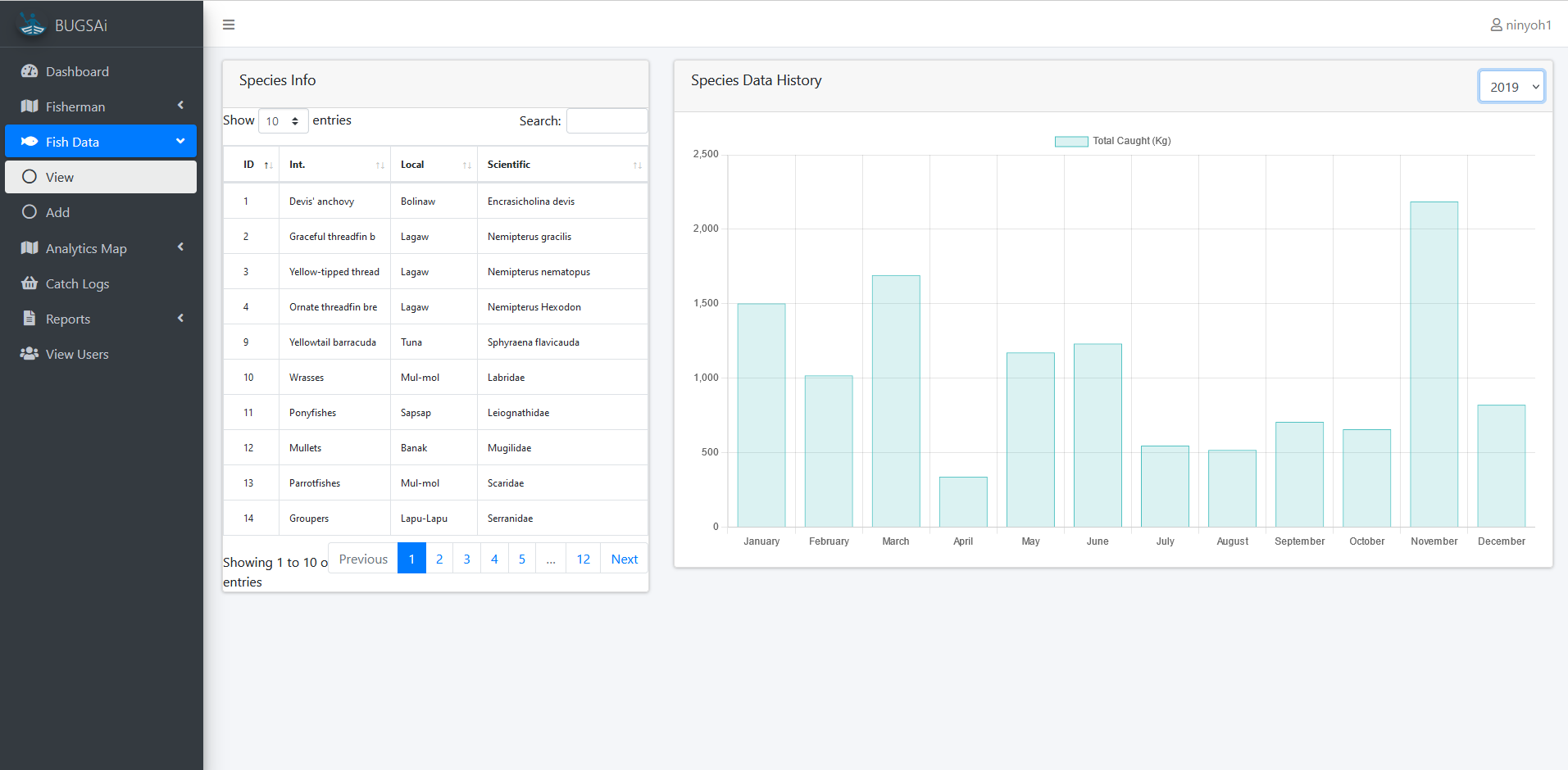
Catch logs by species and gear with analytics-ready aggregation and reports.

Weather-Aware Insights

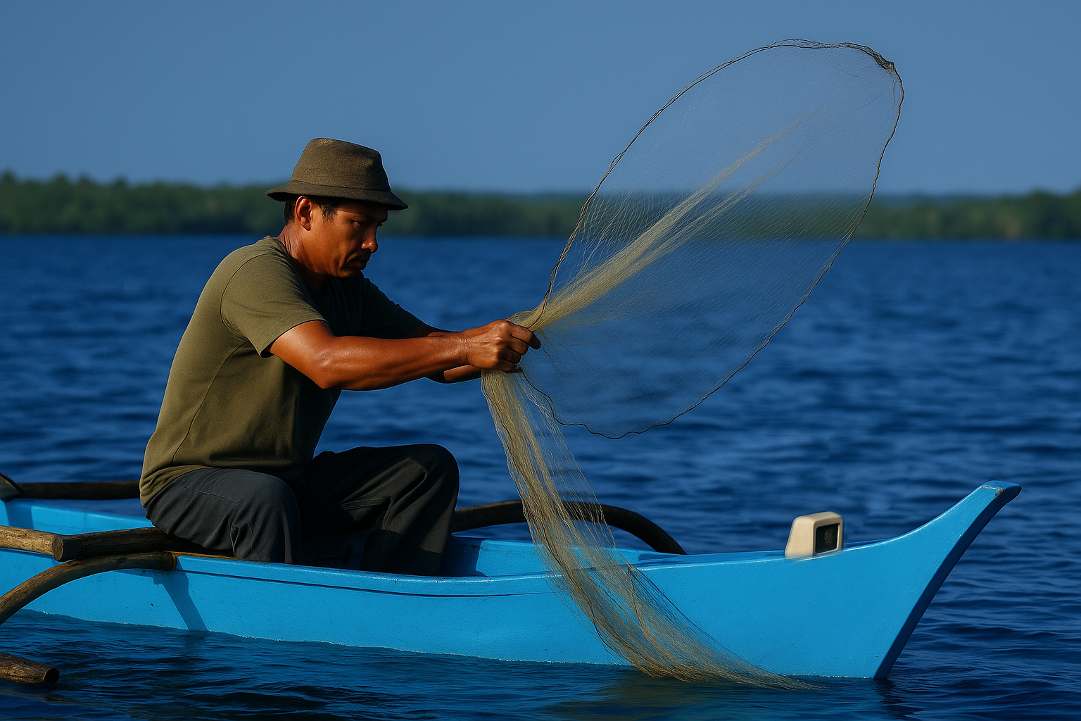
Integrate weather data to support safer fishing operations and better planning.

Analytics Dashboard

Top species, top gear, top fisherman/devices, and monthly trend summaries.

Governance Support

Evidence-based decision support for LGUs, agencies, and coastal program teams.

Community-ready

Built for local adoption, training, and expansion across municipalities and sites.

The App

Screenshots & UI
BUGSAi Dashboard
Dashboard
BUGSAi Weather Patterns
Weather Patterns
BUGSAi Analytics - Fish Data
Analytics
BUGSAi Catch Logs
Catch Logs
BUGSAi Spatial
Spatial View

Want this page to link to your live system?

Use the Login button above to access the production dashboard.

Accomplishments

Key milestones, recognitions, and innovation highlights.
Awards & Grants
DICT Startup Grants Cohort 2
Presidential Filipinnovation Awards 2025 Finalist
PFA 2025 Finalist
Award / Recognition
Awards & Recognition
Awards / Partners
Partners & Milestones
Highlights
  • Selected / included in DICT Startup Grants Cohort 2.
  • Presidential Filipinnovation Awards 2025 finalist.
  • Recognitions and awards for innovation, research, and community impact.
  • Ongoing partnerships for coastal deployment and data-driven fisheries governance.
What this means

These milestones reflect BUGSAi’s readiness for scaled deployment, institutional collaboration, and stronger support for sustainable fishing and biodiversity conservation programs.

Support & Collaboration

BUGSAi is designed for partnerships—LGUs, fisheries offices, community organizations, and research institutions. Collaboration can include field deployments, training, data sharing, and policy-relevant analytics outputs.

LGU / Agencies Universities Fisherfolk Orgs NGOs

Need a pilot deployment?

We can set up a demo, define scope (municipality/barangay), and generate baseline reports.

Our Partners
DICT
LGU Candijay
BISU
BFAR
DEPDev
Filipinnovation
DTI
MP

Contact BUGSAi

For partnerships, pilot deployments, research collaboration, and technical inquiries, feel free to reach out through the official channels below.

Email
info@bugsai.net
Phone
0935 117 2106
Address
Cogtong, Candijay, Bohol, Philippines